Golden Week Day 2 - Chihoku
Golden Week Trip, Day 2 - Tuesday, May 2, 2006
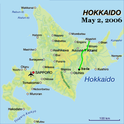 I had all of these great ideas for a subtitle for this post, but I think I'll just let the story tell itself. I'm also going to mix some photos from The Great Train Ride with photos from this trip. All will become evident soon.
Woke up at 3:40. The sky was already light blue. Man, that's just too early for the sun to come up. Luckily, I was able to go back to sleep.
Woke up again at 5:30. This time the sky was as bright as midday. At 5:50 AM. Well, I guess that means it's time for me to get moving. Long day ahead of me.
So I got up, got changed, rolled up my sleeping bag, fixed my seat, grabbed my camera and snapped a picture or two at Ikeda Station before heading out.
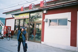 Ikeda Station was where The Great Train Ride began back on April 8th. My plan for this day was to follow the Chihoku Highlands Line and see what some of the surroundings looked like, what with the train being so crowded that I couldn't see out the windows when I actually rode on it.
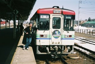 So I got in my car and drove north, following the train line as it headed out toward Kitami. Now, this train line had officially closed down as of April 21st, 2006, so there hadn't been any trains running on the lines for almost two weeks. I was curious to see how the line had changed.
I wasn't ready for what I saw.
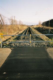
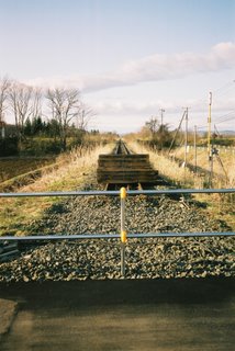

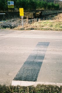
Rails pulled up. Railroad ties pulled up. Crossing guard bars completely removed. Roads paved over. Strange metal blockades at every train bridge and crossing. Stop lines painted over. And that was all before I made it to the first station north of Ikeda Station, Samamai.
When I got there, I was shocked even more.
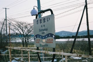
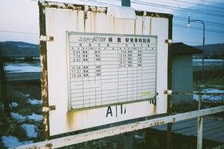
This is what Samamai Station looked like three weeks ago, when Scott, Judy and I rode the rails.
 This is what it looks like now.
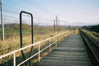
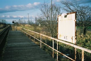 Station sign? Gone.
Time schedule sign? Gone.
Little lamp that lit up the station sign? Gone.
From the way that that station had been taken apart, you would never have known that trains had been running on that line only twelve days before.
It was like that all the way up the line. Some stations still had their names on the station buildings...
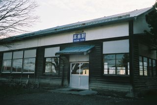 like this one, but the Chihoku Highlands Line had more than its share of platforms out in the middle of nowhere with only a station nameplate to distinguish it from other stations on the line.
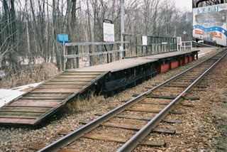
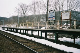 Like these.
But now, all of those platform signs were gone. I planned on taking pictures of every station on the line, but now I had no way of telling them apart. What I ended up doing in a lot of cases was walking or running along the tracks until I found a small yellow sign that listed the name of the station.
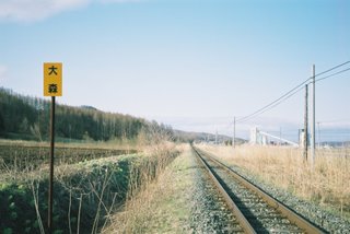
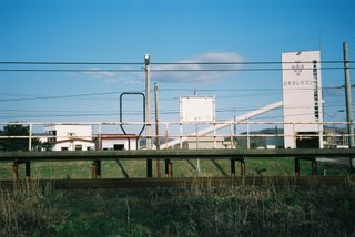 These signs are located on lines about 500 meters before the upcoming station, and function as a warning for the engineer to slow the train down.
So I spent the majority of my day following the train line, running along the tracks, and snapping photos.
(This "running along the tracks" would cause a major problem in the following days of my journey, but we'll deal with that in the next post.)
I saw stations in the middle of nowhere with no obvious reason for there to be a station there...
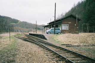 So I pulled my car out onto the train platform and snapped a photo.
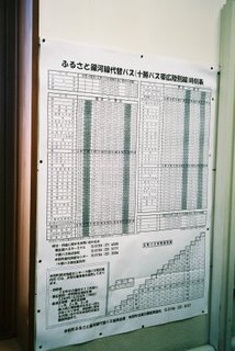
I saw a schedule for the buses that have been set up to replace the trains that no longer run.
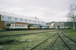
I saw most, if not all, of the Chihoku Highlands Line trains on display at Rikubetsu Station, the halfway point on the line.
I saw a sign advertising Honbetsu Town as the "Number One Bean Town in Japan" and a sign demanding that people "not spill blood in our town" (i.e. don't get into traffic accidents).

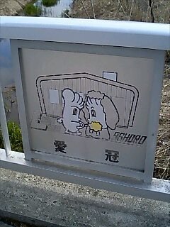
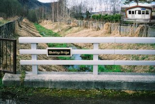
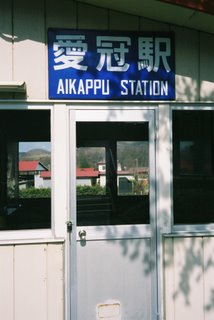
I saw a picture of two feet getting married (a play on the town name of Ashoro, which uses the characters for "feet" and "come together", and a play on the station name of Aikappu, which uses the character for "love" and is, apparently, a popular wedding spot).
As evidenced by this bridge in front of the station.
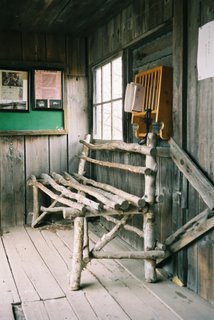
I saw a sign pleading for people to save the Kunbetsu Station waiting room building and the bench within that brings the sitter happiness.
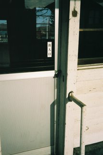
I saw locks on station doors, stations that I had been able to enter merely three weeks before.
I saw a photo display of the history of the Chihoku Highlands Line...
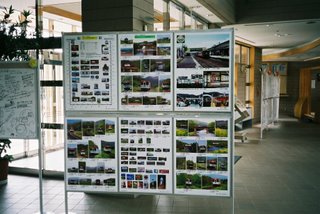
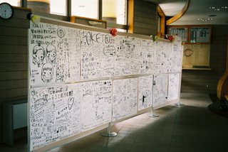
...and posters covered with farewell messages to a train line that was loved and would be missed by those who had used it. (Both taken at Oketo Station.)
The more I drove, the more barricades and pulled-up track I saw (although the pulled-up track stopped about the time I reached Ashoro). The more I drove, the more I saw evidence that a train line had once thrived for close to a hundred years in north-central Hokkaido. It had been there at one time, but now, it was gone. And that made me sad.
Although, when I reached the end of the line in Kitami and swung by the main offices of the Hokkaido Chihoku Highlands Railway, I learned something that was a little surprising, and made me feel a little better.
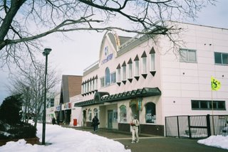
I went in and asked if the train station signs were on display somewhere. The people in the office told me that they had hired a company to remove all the signs and keep them in storage while they contact the various towns along the lines to see what they want to do with them. "The fact is," I was told, "that there's a good chance these signs would have been stolen."
Aaaaaaaaaaaaaaaahhhhhhhhhhhhhhhhhhhhhhhhhhhh.
Now things started to make some sense. Remove the signs before some train maniac can make off with it.
I smiled, thanked the man, and went on my way.
I don't know what will happen with the train line from here on out. There is talk of preserving parts of it, yet some of it has already been removed. Whatever happens, I'm glad I had the opportunity to ride it before it closed, and I'm glad I took the time this day to follow the line. It brought the sad reality of its closing home, yet it showed me exactly how much a part of this region the line had been.
 I had all of these great ideas for a subtitle for this post, but I think I'll just let the story tell itself. I'm also going to mix some photos from The Great Train Ride with photos from this trip. All will become evident soon.
Woke up at 3:40. The sky was already light blue. Man, that's just too early for the sun to come up. Luckily, I was able to go back to sleep.
Woke up again at 5:30. This time the sky was as bright as midday. At 5:50 AM. Well, I guess that means it's time for me to get moving. Long day ahead of me.
So I got up, got changed, rolled up my sleeping bag, fixed my seat, grabbed my camera and snapped a picture or two at Ikeda Station before heading out.
 Ikeda Station was where The Great Train Ride began back on April 8th. My plan for this day was to follow the Chihoku Highlands Line and see what some of the surroundings looked like, what with the train being so crowded that I couldn't see out the windows when I actually rode on it.
 So I got in my car and drove north, following the train line as it headed out toward Kitami. Now, this train line had officially closed down as of April 21st, 2006, so there hadn't been any trains running on the lines for almost two weeks. I was curious to see how the line had changed.
I wasn't ready for what I saw.


Rails pulled up. Railroad ties pulled up. Crossing guard bars completely removed. Roads paved over. Strange metal blockades at every train bridge and crossing. Stop lines painted over. And that was all before I made it to the first station north of Ikeda Station, Samamai.
When I got there, I was shocked even more.
This is what Samamai Station looked like three weeks ago, when Scott, Judy and I rode the rails.

 This is what it looks like now.
 Station sign? Gone.
Time schedule sign? Gone.
Little lamp that lit up the station sign? Gone.
From the way that that station had been taken apart, you would never have known that trains had been running on that line only twelve days before.
It was like that all the way up the line. Some stations still had their names on the station buildings...
 like this one, but the Chihoku Highlands Line had more than its share of platforms out in the middle of nowhere with only a station nameplate to distinguish it from other stations on the line.
 Like these.
But now, all of those platform signs were gone. I planned on taking pictures of every station on the line, but now I had no way of telling them apart. What I ended up doing in a lot of cases was walking or running along the tracks until I found a small yellow sign that listed the name of the station.

 These signs are located on lines about 500 meters before the upcoming station, and function as a warning for the engineer to slow the train down.
So I spent the majority of my day following the train line, running along the tracks, and snapping photos.
(This "running along the tracks" would cause a major problem in the following days of my journey, but we'll deal with that in the next post.)
I saw stations in the middle of nowhere with no obvious reason for there to be a station there...
 So I pulled my car out onto the train platform and snapped a photo.
I saw a schedule for the buses that have been set up to replace the trains that no longer run.

I saw most, if not all, of the Chihoku Highlands Line trains on display at Rikubetsu Station, the halfway point on the line.

I saw a sign advertising Honbetsu Town as the "Number One Bean Town in Japan" and a sign demanding that people "not spill blood in our town" (i.e. don't get into traffic accidents).

I saw a picture of two feet getting married (a play on the town name of Ashoro, which uses the characters for "feet" and "come together", and a play on the station name of Aikappu, which uses the character for "love" and is, apparently, a popular wedding spot).

As evidenced by this bridge in front of the station.

I saw a sign pleading for people to save the Kunbetsu Station waiting room building and the bench within that brings the sitter happiness.

I saw locks on station doors, stations that I had been able to enter merely three weeks before.


I saw a photo display of the history of the Chihoku Highlands Line...

...and posters covered with farewell messages to a train line that was loved and would be missed by those who had used it. (Both taken at Oketo Station.)

The more I drove, the more barricades and pulled-up track I saw (although the pulled-up track stopped about the time I reached Ashoro). The more I drove, the more I saw evidence that a train line had once thrived for close to a hundred years in north-central Hokkaido. It had been there at one time, but now, it was gone. And that made me sad.
Although, when I reached the end of the line in Kitami and swung by the main offices of the Hokkaido Chihoku Highlands Railway, I learned something that was a little surprising, and made me feel a little better.

I went in and asked if the train station signs were on display somewhere. The people in the office told me that they had hired a company to remove all the signs and keep them in storage while they contact the various towns along the lines to see what they want to do with them. "The fact is," I was told, "that there's a good chance these signs would have been stolen."
Aaaaaaaaaaaaaaaahhhhhhhhhhhhhhhhhhhhhhhhhhhh.
Now things started to make some sense. Remove the signs before some train maniac can make off with it.
I smiled, thanked the man, and went on my way.
I don't know what will happen with the train line from here on out. There is talk of preserving parts of it, yet some of it has already been removed. Whatever happens, I'm glad I had the opportunity to ride it before it closed, and I'm glad I took the time this day to follow the line. It brought the sad reality of its closing home, yet it showed me exactly how much a part of this region the line had been.


0 Comments:
Post a Comment
<< Home